AI Analytics + Edge Intelligence
Engineering Intelligence, Not Just Monitoring
80,000+
05+
Application Domains
Climate · Environment · Geotechnical · Infrastructure · Agriculture
02
Core Intelligence Engines:
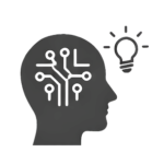
AI Analytics Core + Edge AI Models
Global
Engineering-Focused Collaboration
Pillars of Technology
Analytics
Edge AI
Recognition
Insight
RAUZ AI Analytics Core
RAUZ develops AI analytics frameworks designed for environmental and geotechnical monitoring systems operating in complex field environments.
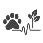
Environmental & Geotechnical Intelligence Engine
“Turning distributed monitoring data into engineering-grade insight.”
RAUZ enables structured interpretation layers that enhance clarity, support engineering judgment, and improve long-term visibility across distributed assets.
We turn these challenges into capabilities:
• Underutilized data → Actionable intelligence
• Fragmented workflows → Unified interpretation
• Hidden risk trends → Early visibility
• Inconsistent thresholds → Data-driven consistency
• Lost knowledge → Reusable project insights
Edge Intelligence for Field Conditions
“Intelligence where connectivity ends.”
RAUZ builds edge-ready AI models designed to operate within real-world field environments where connectivity and infrastructure may be limited.
What our edge AI unlocks:
• Real-time recognition — no waiting for cloud processing
• Consistent responsiveness across all sites
• Local adaptability to field conditions
• Scalable intelligence across distributed infrastructure
• Reduced dependency on connectivity and approvals
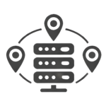
RAUZ Edge AI Deployment
Edge AI capabilities support localized recognition, faster insight generation, and improved operational adaptability in environmental and geotechnical systems.
RAUZ Risk Pattern Recognition
RAUZ enhances structured awareness of evolving field conditions, supporting informed engineering decisions across infrastructure and climate-related projects.
Intelligent Risk Evolution Modeling
“From raw signals to structured risk awareness.”
RAUZ develops analytical models that support long-term pattern recognition across environmental, hydrological, and geotechnical datasets.
What our models deliver:
• Signal clarity — distinguish meaningful change from background noise
• Risk visibility — track slow-moving accumulation that precedes failure
• Expert amplification — codify domain knowledge into scalable models
• Temporal continuity — connect fragmented datasets across time and location
• Early recognition — deployable frameworks for proactive intervention
Engineering-Focused AI Advisory
“AI-enhanced decision support for complex monitoring environments.”
RAUZ works alongside consultants, system integrators, and infrastructure operators to embed intelligent analytics into monitoring strategies.
How we deliver value:
• Unlock underused data from existing monitoring systems
• Reduce operational costs through intelligent automation
• Standardize analytics across distributed sites
• Bridge the gap between raw data and ESG/compliance reporting
• Translate monitoring output into actionable strategic decisions
RAUZ AI-Integrated Monitoring Advisory
RAUZ supports scalable, engineering-aligned intelligence layers that complement existing monitoring systems and enhance long-term project resilience.
CORE APPLICATIONS
Farm Soil Health
Continuous analysis of soil moisture, salinity, and nutrient trends — enabling precision agriculture decisions without dense sensor networks.
市场痛点
Constructio Safety
Real-time pattern recognition from inclinometers, piezometers, and settlement cells — alerting teams to slope movement or pore pressure changes before failure.
Smart Cities
Distributed monitoring of subsidence, underground water levels, and infrastructure health — integrated with urban digital twins for proactive maintenance.
Climate Adaptation
Long-term trend analysis of hydrological and geotechnical parameters — supporting resilience planning for floods, droughts, and permafrost thaw.